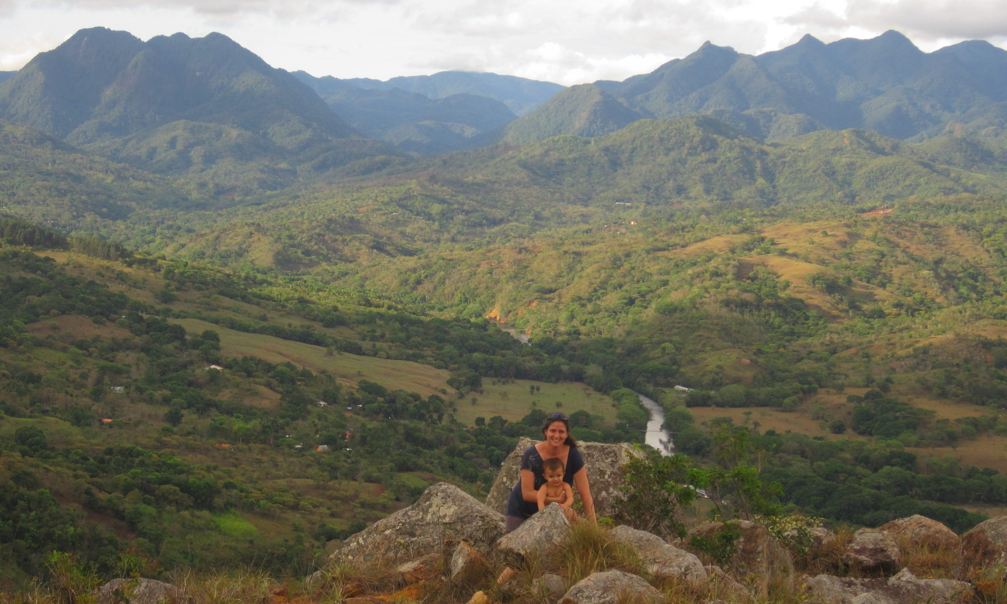
Lauren in Santa Fe National Park, Veraguas Source: Panama Portal
Last week we had Lauren, from Panama Portal, a website focusing on Panama travel, stop by! Check out her review of our hotel, and trip highlights in Santa Fe:
Country Church in San Francisco, Veraguas, on road to Santa Fe. Like what you’re momma taught you -don’t judge a book by it’s cover. Rustic outside – over the top baroque interior.
So, I admit, I’m not a big church tourist traveler. Something about ornate wood in enclosed spaces makes me impatient. Now, let me note, I am Catholic, and not liking ornate decorations, has nothing to do with faith itself (see Mom). We stopped by the Iglesia de San Francisco in San Francisco, a small town on the road between Santa Fe and Santiago. I wouldn’t choose it for a trip in itself, but it’s worth a side visit.
What’s special about the Iglesia de San Francisco in Veraguas?
While it doesn’t look like much from the outside, it’s one of the oldest chuch’s in Veraguas, founded in 1621 about a year after the founding of the community itself. It is likely the best example of baroque art in the country, and the interior is unique where indigenous influence can be seen in the art. The alter is gold encrusted and among the oldest Baroque alters in the Americas.
Inside the church. Photo Source: Autoridad de Turismo, Panama
In the 1600s, the population of San Francisco was quite small (30-50 indigenous families). By the 1700s, the town had grown to nearly 3000, and this is when it is believed that the decoration of the interior started. The church underwent major repairs in the 1930s after an earthquake toppled the former 4 story bell tower. Recently, plans have been approved (without funding) for restoration of this church.
Today, the church is a national monument, and is being considered for a UNESCO site.
Do you recommend going?
This isn’t my usual type of travel destination.That being said, it can make a perfect little side trip to stretch your legs on your way to or back from Santa Fe. There is a nice little typical Panamanian restaurant, Charilynn’s (spelling)on the main road. Good food, good price, and clean.
How do I get there?
The church is off the main road from Santa Fe – Santiago. If you’re heading North from Santiago, make a right into town. If you’re heading south from our hotel, make a left into town – don’t forget to grab a bite at Charilynn’s. Some of the cleanest bathrooms I’ve seen in a restaurant, excellent food, and honest service.
When I was working for the Forest Service, I heard of a family that tried to follow Yahoo maps directions that found the shortest distance between two major town…. along US Forest Service Roads, the unmaintained, forget paved, not even graded kind. Got stuck, and then were complaining that it was on Yahoo. This was years ago, and directions have since improved…in the US.
If you’ve searched for Santa Fe, Panama on Google Maps, you’ll see a nice, yellow line marking the highway between Santa Fe to the Caribbean. You think, oh fun! I could visit the beach.
Ah no.
I love the map in that it builds hope that one day this construction project potentially could be completed. This could be referred to as a visionary map, a hope map, a potentially some day, somehow, somewhere this road will be built map. Of course with a town of 300 as the final destination and 30km to cut the road one wonders about the funding, but it could be possible map.
But please don’t view it as a road map. You may hear me on the posts refer to a site being along the “road they’re building to Calovebora”. This should be interpreted much in line with “along the beach that will be formed when the bedrock erodes” or “near the canyon that will form with the flow of the creek in the back of our inn”…This road has been in the process of being built for a few years, with current funding to go to Rio Luis, which is about 3/4 of the way to Calovebora. However, between you and me, many road projects never meet their objectives. Rio Luis, Santa Fe, Panama on Road to Calovebora
So,while you likely won’t visit Calovebora on this trip, I don’t blame you for being curious…and the road is a wonderful trip in itself. Cele and I went hiking to Rio Luis. The mini-San Francisco like suspended bridge connects Bocas del Toro. I’ll write more about the road itself in another post!
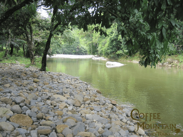
In Santa Fe, Veraguas and ready for a dip in the river or a float in a tube? Downhill (going there, definitely not going back – if you’ve seen that hill, you know what I’m talking about) from the hotel is one of the prettiest lazy swimming holes, surrounded by tall trees and a nice river. It is a bit rocky, so I wear my flip flops in the water.
How to get there?
Go downhill from our hotel about 400m until you hit the Bulaba bridge. Cross it, and on the other side to the right, make your way down to the river. The swimming hole is downstream about 100m
Be careful and aware
Who would I be without cautionary words. While the river is calm in this area much of the year, there are times that the water and velocity is high. Use common sense – if it looks dangerous – don’t do it.
UPDATE: naming of the Charco
Since originally writing this post last week, I’ve learned of two background stories about Charco Piedra del Pato. See which one you like the best. The first is from Nathali who says she read the story in a book of legends of the area, the second from her mom, Villa.
1) From Nathali: The swimming hole is located on the Bulaba River, named for an indian cacique Bulaba. Bulaba had a beautiful daughter who fell in love with a man from a neighboring tribe. They would meet at night at this pool. After realizing that his daughter was sneaking out at night to meet with her love interest, Bulaba was not happy and wanted to put a stop to the romance. He went to see a warlock who turned the boyfriend into a duck (pato). The daughter went at night to wait for her boyfriend, sitting on the big rock in the middle of the second photo – she sat and sat, he never came. Thus, the area was named the Pool of Duck Rock (Charco Piedra del Pato)
2) From Villa: There used to be a lady named Sra Inez who lived on the river. She had many ducks and the ducks used to perch themselves on the rock. Thus, the area was named the Pool of Duck Rock (Charco Piedro del Pato).
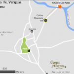
How to get to Charco Pato
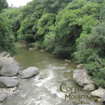
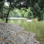
Looking towards the swimming hole from the Pantano Bridge
How did I end up looking for petroglyphs in Santa Fe?
When I was fifteen, my mom decided to take a six hour detour through the desert of Utah (in the summer) down dirt roads to look for these reported petroglyps. After bouncing down the sandy road in our minivan, miles from no where, dust in my mouth, hot wind in my eyes, we came to a large rock pile. It was well over 100 outside, I was fifteen, and underwhelmed would have been a kind word to describe my emotion at seeing a series of blurry etchings on rocks.
So, how the heck did I end up bouncing down a dirt road years later, miles from nowhere, on the road from Santa Fe to Calovebora in search of petroglyps? And how did I enjoy it?
A little history is key
I think the drive through the rainforest had a lot to do with it. Who would not enjoy a drive down dirt roads, where each turn in the road gives a new view, and clouds hang on surrounding hills. Next, I read a bit about it before going.
According to Granger’s 1969 Review, the Carib people, carved these etchings roughly 1000 years ago, and the petroglyphs themeselves generally are carved on a rock facing water, and furthermore many are angled upstream or towards a mountain range from where the water comes. I know that was true for this one, though I did hear a rumor that the rock was moved a bit to the side of the road with the construction of the new road. Regardless, there is something magical about tracing the indentations with your hand, and wondering who else’s hands have passed there.
How did I get there?
We took the road from Santa Fe to Calovebora on the West Entrance to the Park. There are a couple of sites where petroglyphs can be explored. The round trip took about 2 hours, and yes, I would recommend a four wheel drive for access.
What did I enjoy most?
I am an ecologist at heart, and I loved feeling very Indiana Jonesish going through these quiet rainforest backroads, the petroglyphs are an added bonus.