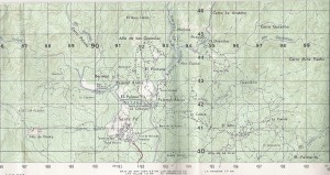
 I love topographic maps of rural areas, I can spend hours looking over them, the rural towns, the square boxes that mark one home, one life. The dashed lines that mark roads/paths or trails between these small communities. Trails to walk, views to see.
When my husband was dating me, he brought me two presents that I have on my wall: the topographic map of Santa Fe (scale 1:50,000) and of Calovebora to the north.
The town itself, Santa Fe, is one of the oldest cities/towns in Panama, founded in the 1500s, and was once the regional (viceroyalty) capital. Place names in the history books found in their present day adaptations on the map. “Veragua” to “Veraguas”. “Calobegola” to “Calovebora”. And others you wonder where they came from, like “Narices” or Noses.
