El Mirador in Santa Fe National Park, Veraguas

El Mirador, Santa Fe National Park

When you watch a two year old all day, even if he is your son, you can go a little crazy.  Earlier this week, Little Boy (my two year old)  and I were off for a local drive up to the continental divide in Santa Fe National Park just to get out of the house for a bit- maybe go for a swim.  Of course, he fell asleep along the way, but I wanted to explore a bit, so we went to El Mirador instead.

What is the Mirador?

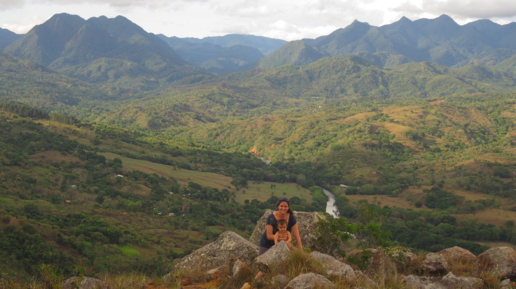
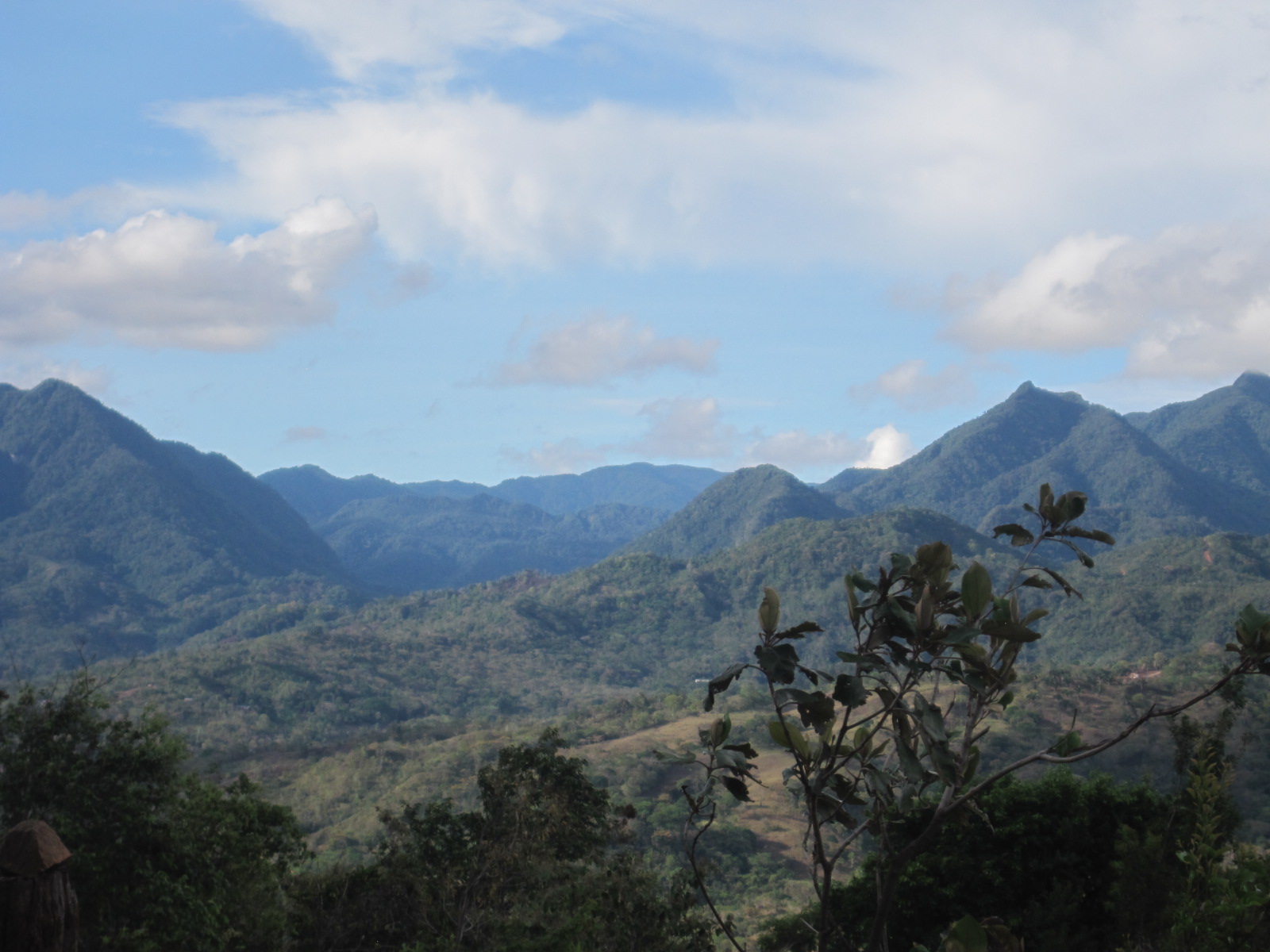
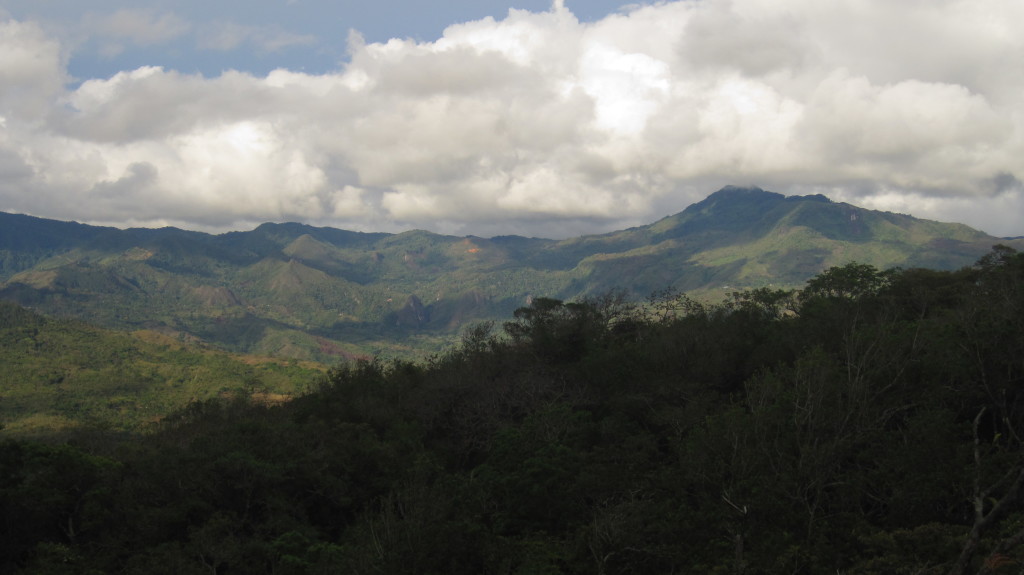
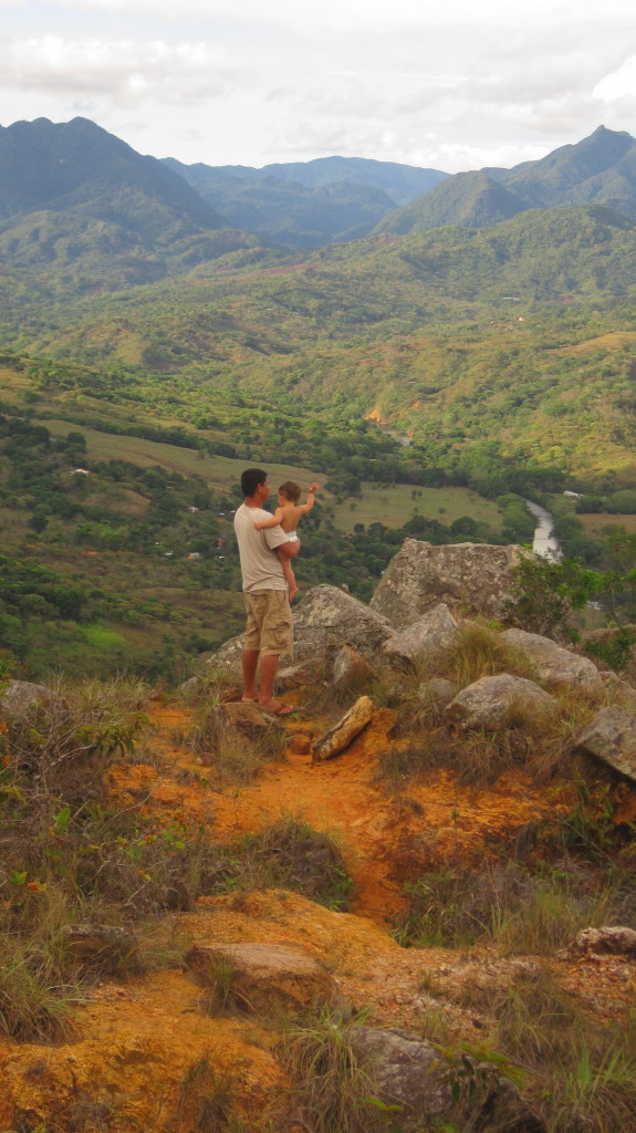
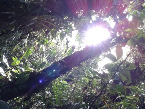
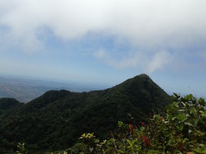
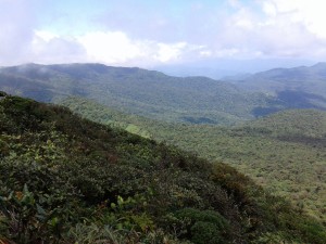
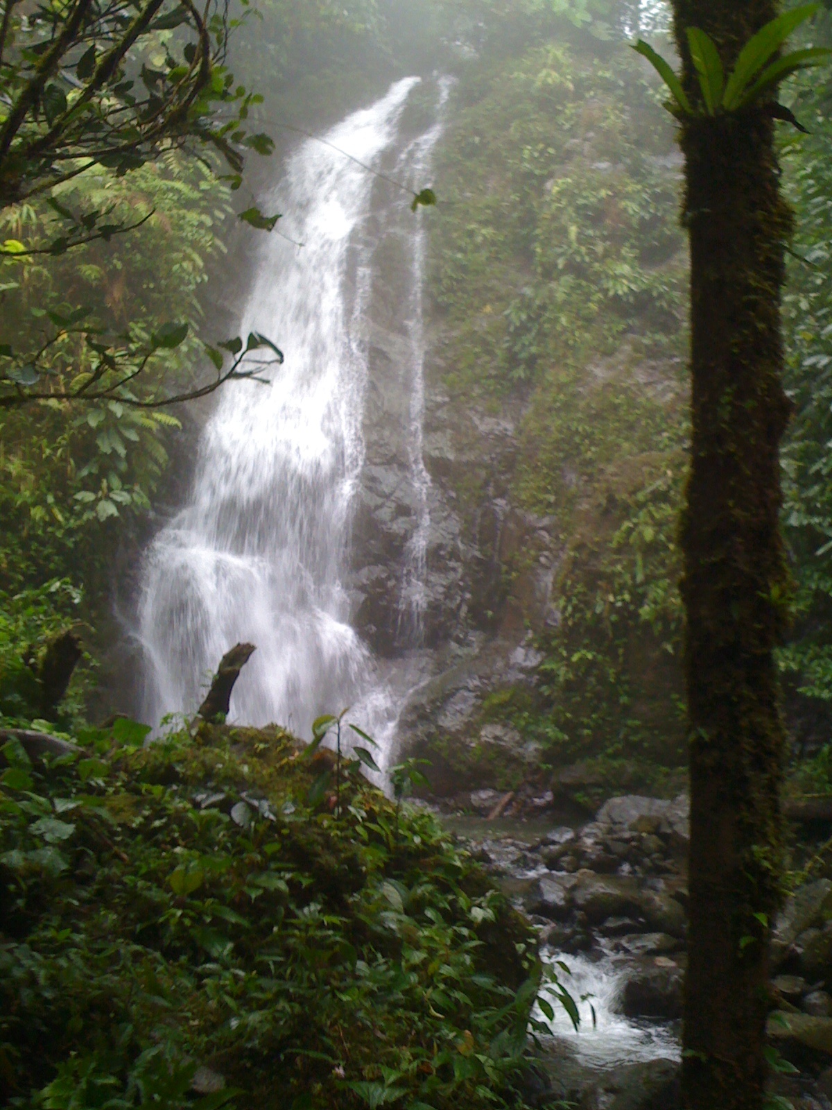
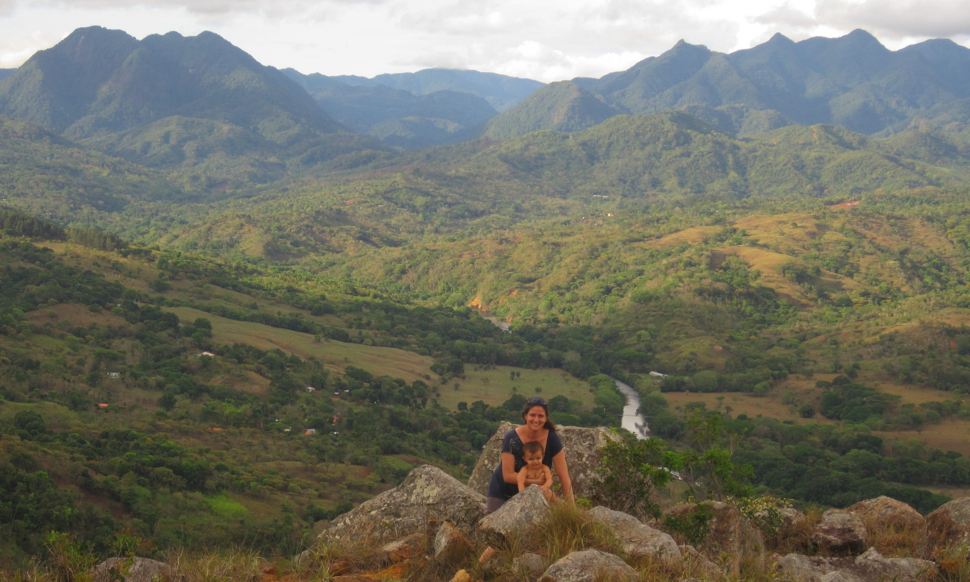
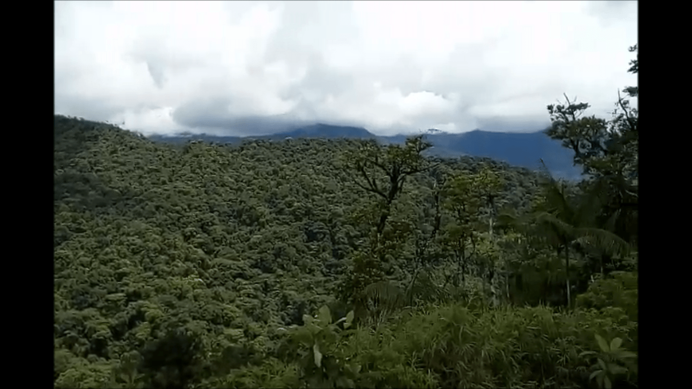
The mirador (or viewpoint) is a parking area located immediately after the continental divide on the Caribbean side of Santa Fe National Park.  The unpaved parking area was leveled out with the building of the road, some 4 years ago, leaving a nice place to stop and take pictures.  The views are beautiful, down towards the Calovebora valley, and the Comarca.  You can spot small indigenous villages in the distance, view mountain ranges, and observe the difference in vegetation between the forest of the protected National Park and farming of communities below.  The muddy, leveled out area (car should have 4×4 if you decide to park), is surrounded by the cloud forest.  Here, the effects of heavy winds can be seen near the ridgeline with shorter, windswept trees.

How to get to the Mirador, Santa Fe National Park

On the road towards Guabal, it is located about 1km after the National Park office in Santa Fe National Park, on the right hand side.  There is a short driveway leading to a flat, unpaved parking area.

What to do at the Mirador

I got my trusty rubber boots on and went stomping around the parking area while Little Boy slept.   Since it is unpaved, the area can get really muddy, and it is surrounded by the jungle.

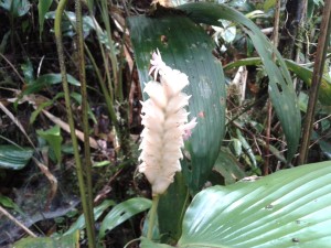
I am continually amazed how something inauspicious (parking area) is loaded with really neat sights. The trees are pretty bare, making it easy to spot some of the orchids in bloom, huge philodendrums and bromeliads…but my favorite…these amazing leaf cutter ants!

I fell in love with Santa Fe -again

Fabulous Santa Fe Views

I went on the most BEAUTIFUL 4×4 drive with Cele and Rafael on the 3rd up on a little known route towards Cerro Tute along a place called Cerro Redondo.  We had 180 degree views of the mountains, of Santa Fe National Park, of the town of Santa Fe, of the beautiful Santa Maria River that traverses the valley.

So the thing is this, I was wrong.  OK.  I’m going to go ahead and say it- I was wrong.  I’ve always been underwhelmed about Cerro Tute as a destination in the area.  It’s written up in all of the guide books (by people who only visit the area overnight – I argue), as somewhere to visit.  (Why spend 5 hours hiking up an unforested hill, when the rainforest of Santa Fe

National Park is right there, I would argue).  Don’t go to Cerro Tute, go to Cerro Mariposa I would tell guests.

Ascending Views of Santa Fe National Park
Cerro Narices

We took a 4×4 road off the main road of Santa Fe to Cerro Redondo (between Montanuela and the Community of Tute Abajo).  The dirt road was in good condition, and while we definitely needed 4×4, it was easily passible.  The road connected to the road to Cerro Tute, and we looped back down to Santa Fe.  Total time: 1.5 hrs.

I would love to come up with a tour that goes along this route – sunset horseback ride anyone?  While I still maintain that the normal route to Cerro Tute is not that great (not what you should do if you only have a couple days in the area) – this route is.  And is a great short alternative.

Cerro el Sapo

Cele and Rafael on Cerro Redondo


Cerro Mariposa, Santa Fe Veraguas

I’ve always been intrigued by Cerro Mariposa.  It’s one of the two mountains that make up the western arm of Santa Fe National Park; it’s mentioned by birders and scientists, as a refuge for species, but it’s not that popular with tourists because it’s hard to access. Unlike Cerro Tute, where you have farms and a 4×4 road to the top, Cerro Mariposa is a six hour round trip hike on a footpath some of the year (and with a machete the rest of the year) in mud and rainforest to reach the peak – and a guide is a must.

We recently had a group of more adventurous guests make it up there, and I’ve asked Edgar, the guide, to guest write a post:

Just the Facts

Elevation: 1,424m

Location: Western Arm, Santa Fe National Park

Type of Vegetation: Rainforest

Hike Duration: 6hrs Round Trip

Ascending Cerro Mariposa

Sunrise through the forest ascending Cerro Mariposa in Veraguas

It was 7AM, March 15, 2016 when the group of explorers, Josepus, Oliver and Edgar (me, the guide), prepared to set off on the hike to Cerro Mariposa, located in Santa Fe National Park, at an altitude of 1,424m.  We spent 20 minutes driving from Coffee Mountain Inn to where we began the hike in Alto de Piedra.   We began our hike accompanied by the songs of diverse bird species. And we weren’t alone.  100 meters from where we began, we spotted Jaguar and Ocelot tracks and soon came across a Trogon (Trogon aurantiiventris) very close to the trail.  600 meters later we found one of the Jaguar monitoring stations that use trigger cameras to capture night life with a motion sensor (take a look at other work of  AMIPARQUE (Amigos del Parque Nacional Santa Fe)).  I showed them some previous fotos that had been taken by the cameras.  We could also hear Keel-billed Toucans and a Great curassow (Crax rubra).

Calathea species along trail: Cerro Mariposa, Santa Fe, Veraguas

In the midst of the forest, we saw many different plants with flowers like the newly recognized species of Calathea (Calathea galdameciana), endemic to the area and discovered by scholarship student through Smithsonian Tropical Reseach Institute (STRI).  Orchids, bromiliads, mosses, ferns, athurium and philodendrons were plentiful.

After walking for three hours, we ascended from the rainforest to the dwarf rainforest of the ridgeline.

Arriving to the Peak of Cerro Mariposa

We reached the peak.  At first it was cloudy, but then we hit a break in the clouds after a few minutes. The ridgeline of El Tute extended before us, the town of Santa Fe far below, and the rainforest of the National Park on the hills below us.

Cerro Delgadito, Southward View from Cerro Mariposa, Santa Fe, Veraguas
From Cerro Mariposa, looking over Santa Fe National Park, Panama

We rested, taking in the beautiful views offered to us, with the clouds in our face, the constant wind, cool temperatures before descending again.  Halfway through the decent we were surprised to spot a rare lizard (Anadia Vittata), hard to spot because of the camouflage in dry leaves.

We arrived at the end, in perfect health, happy and thrilled with the adventure.

Bermejo Falls, Santa Fe

Bermejo WaterfallOne of my husband’s favorite waterfalls next to Santa Fe is Bermejo Falls, located about 3 miles to the northwest on a 4×4 road.

What are my impressions of Bermejo Falls?

It’s a beautiful area-and definitely worth a day trip.  The falls themselves are located on el bermajito river.  A 60 ft waterfall cascades down to a rocky pool (with very slippery rocks) where you can swim.  Forested cliffs reach up around the falls.  The pool is larger than any of the waterfalls at Alto de Piedra, and the view is more impressive. Guests have seen monkeys at the falls and my husband saw an ocelot one morning.  It is a longer hike to get to the falls, however – through an EXTREMELY muddy trail.  Then the trail meanders through a cow pasture and an orange grove, making it easy to lose it.

Hiking the trail requires mobility – and takes about 45 minutes one way – but what a 45 minutes it is!  Let me first say that Bermejo means red soil.  What type of soil is red?  Clay.  What happens when horses pass over clay soil in a rainforest?  You get a muddy, slippery mess of a trail for hiking!  I was pondering this as my black rubber boots sank down in the mud past my ankles, sometimes up to my calves as I desperately was looking for firm ground my first time hiking the trail.  Some months it is drier, but be prepared for mud!

How to get to Bermejo Falls

We offer a horseback riding tour to the falls, $95 for two people and $25 for additional people – people love it.  But don’t feel obligated if horseback riding isn’t for you – I want people to have the experience that’s right for them, and that’s not for everyone.  You can also drive to the trailhead and hike, if you have a 4×4.  Budget in about 20 minutes in a 4×4 to drive the 3 miles, and 2 hours to hike there and back with some time at the falls.

Others hike from our inn, but they usually come back wiped out.  We recommend taking a taxi ($5 – $6 for the first person + $ for each additional person) to the falls if you don’t have a 4×4.  That way you’re not too tired to enjoy the waterfall when you get there.  You can catch a taxi in the town square.

To get to the trailhead, continue downhill from our inn, cross the vehicle bridge and take the first left up the steep hill.   Continue making lefts when the road splits until you hit a small chapel.  When the road splits, take the right fork and continue on the 4×4 road until you see a sign for Bermejo Waterfalls on the right hand side.  Park your car and the hike should take about 45 minutes to get to the falls.  Be careful of the slippery rocks near the falls.

This is not an official tourist trail.  It is not maintained – it’s a foot path that farmers use to access their lands, and you hike through private land to get to the falls.

Exploring Santa Fe, Panama Trails Part 3

Waterfall at Alto de Piedra
Third Waterfall, Alto de Piedra, Santa Fe, Panama
waterfall top
The third fall is surrounded by rainforest, and forested hillsides surround the falls in three directions.


Alto de Piedra – The Final Waterfall

I have been mentioning the three waterfalls at Alto de Piedra.  Last but not least, the third fall can be reached from the same trailhead area as Waterfalls 1 &2, but by a different trail.  Rather than taking the trail behind the white building, you set out on a footpath to the left, in front of the building, ascending a short hill for 100m before taking a footpath to the right (where there are a group of tires to help you pass the mud) descending another 700m or so to the third waterfall.

The fall is absolutely gorgeous.  It’s larger than the first waterfall, with a larger drop to a pool below – where you can swim!  When I went, I have enjoyed getting my feet wet in the pool, but there is not much comfortable sitting room on the river rocks. I also had a dangerous situation when an unstable  boulder that I was sitting on that tipped over.  As you enter the pool area, you’ll be surrounded by cliffs.  You’ll note a landslide to the left, all underlining the need to be careful of big boulders in areas with wet, saturated soil.

The Trail

Trails in Santa Fe are not the maintained trails that many hikers may be used to.  They are more either 4×4 dirt roads or horse trails or narrow footpaths.  For these waterfalls, the trails are footpaths, ranging from 1m to 1ft in width.  They are not maintained for hikers, rather for local people who happen to use them. In wet season, the paths can be overgrown.  The third waterfall footpath is  very muddy and descends through the rainforest.  It takes me about 20 minutes to descend and 25 to ascend again to the parking area.  There is one large tree that has fallen across the trail.  It’s very slippery. This marks the point wherea very narrow, steep footpath that connects to the trail for Waterfalls #1 and #2, but I do not recommend taking it. When ascending from the third waterfall, it is easy to take this trail by accident