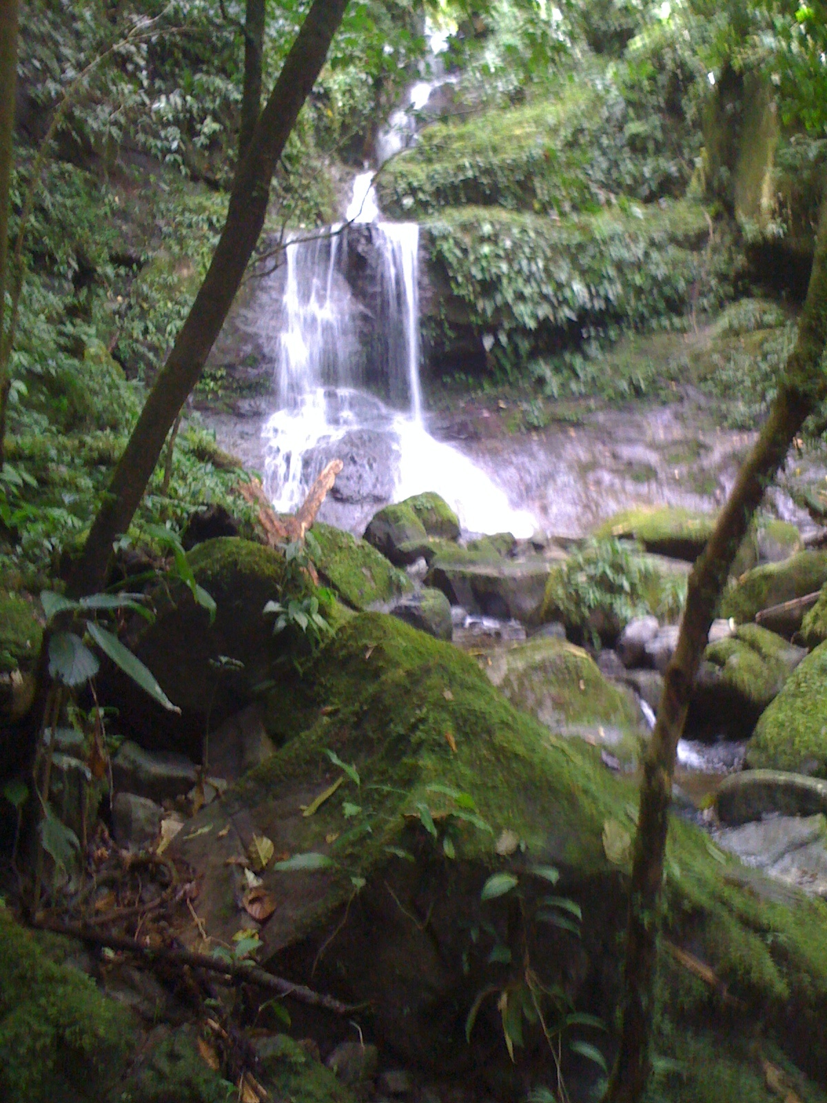
Second Fall, Alto de Piedra
There are a series of three waterfalls at Alto de Piedra. The second is my favorite, and the hardest and most dangerous to get to. The waterfall is made up of four mini waterfalls, cascading about 80-100ft to the forest below. Beautiful!
How to get there:
The safest way to get to the waterfalls is to take the trail to the first waterfall, described in the previous post. About 100ft before you reach the first waterfall, there is a footpath from the main trail, leading upwards. Take this trail, and follow for about 8 minutes and you will reach the falls. I just was on this trail today. Be very careful, it is very muddy, narrow, not maintained and with very steep drop offs. There are areas where you will need to grab on to roots to balance yourself, and you should wear boots. If you have poor balance or mobility issues, this trail is not for you.
TRAIL LENGTH FROM TRAILHEAD: Approx 800m; Plan 1 hr for a round trip visit to the second waterfall.
Alto de Piedra waterfalls are very pretty, and a perfect taste of the region.
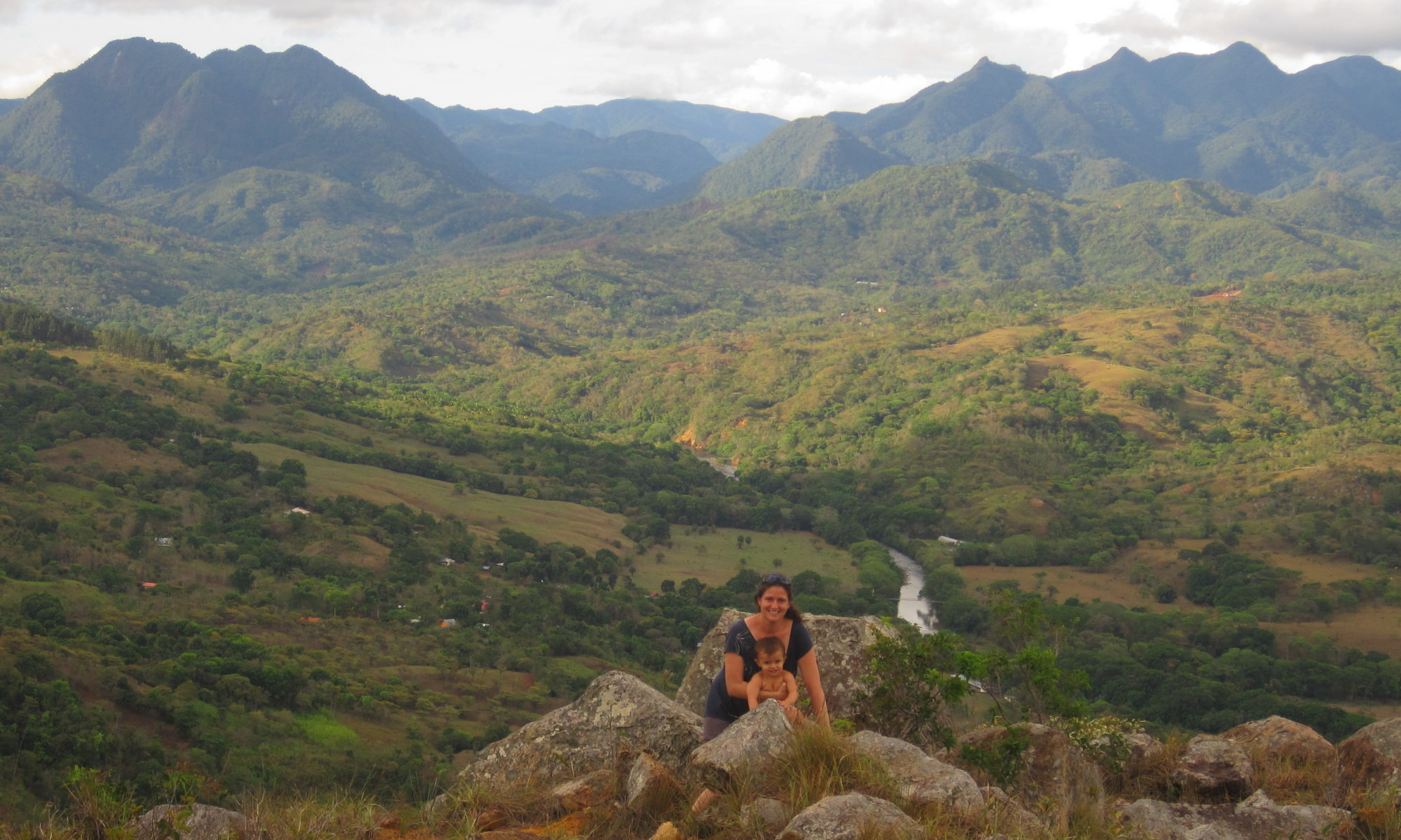
Alto de Piedra is an outlying neighborhood of Santa Fe. The trailhead is about 3 miles and 1000ft above Santa Fe town center, bordering the National Park. There are a series of three waterfalls.
Trail description
The trail to the first waterfall descends about 400 ft in 1/2 km through rainforest. The trail was paved in places at one time, though it is always muddy, steep, and not well maintained. It is the easiest of the three trails, but still slippery and muddy -I wear my black rubber boots to hike it. You will see typical rainforest trees – stilt palms, guarumo, strangler figs. After descending 400 ft, you come to waterfall, perhaps 20ft in height, as steep forested slopes with large ferns surround the pool in 270 degrees. Very pretty. In the morning, we’ve seen hummingbirds play in the falls.
How to Get There
Waterfall Trailhead Location in Alto de Piedra
The trailhead is located off of the paved road that goes towards Calovebora. On the other side of the uncompleted center, see picture below. (please note, this is NOT the same information center as the one that my husband helped complete) the trail starts out, wandering through an orange grove before starting its descent.
House at Trailhead for Waterfalls, Waterfall 1 trail is located on the other side of the fence in back of the white house.
In November, we’re going to start a bike and hike rental option, with bike rental and trailhead drop off for those people who would prefer to rent a bike, be dropped off at the trailhead, do the short hike, and coast down the 1000ft elevation change and three miles back to town.
What to Bring
Water. Though the hike is short, uphill in heat is not my favorite. I bring a bottle of water with me.
Long-sleeve shirt. I wear a long sleeve shirt for the bugs, and put on insect repellant before I go.
Sturdy shoes.
Be aware that there is no cell reception in the Alto de Piedra area.
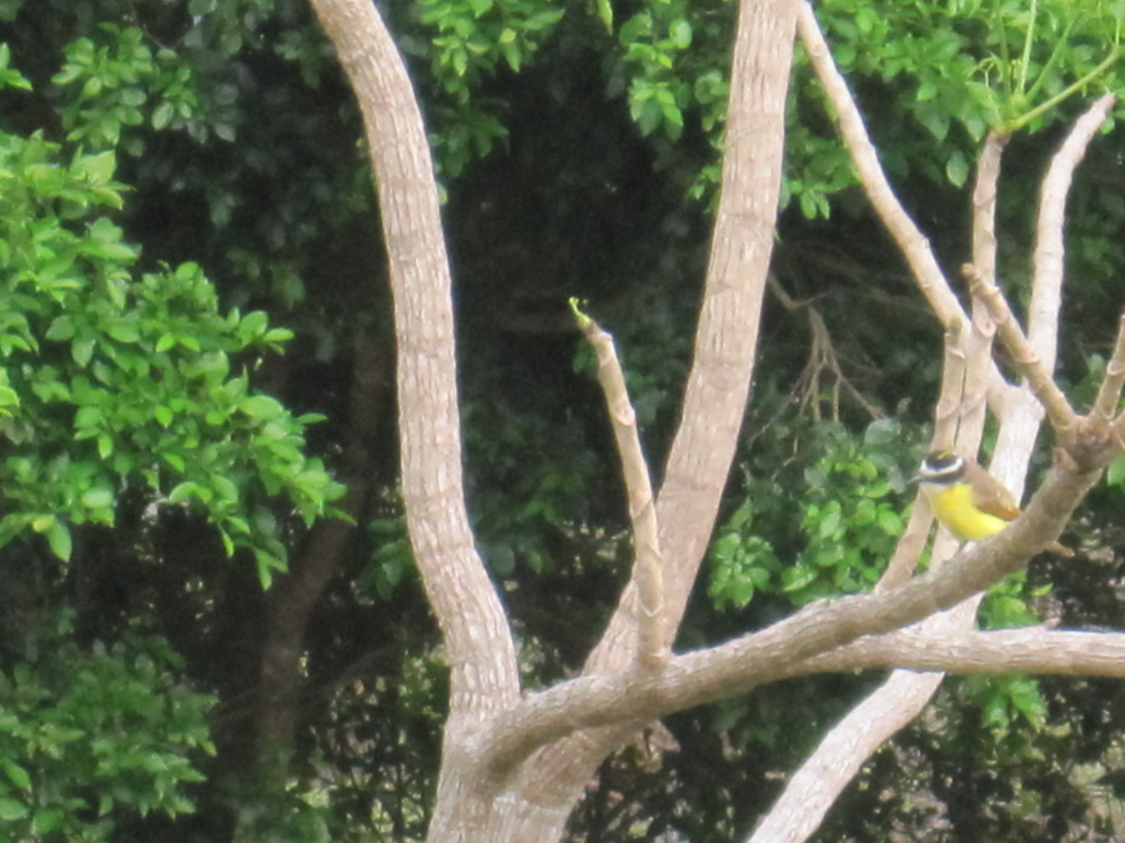
I spent last weekend checking and cross-checking bird species for the Santa Fe region in Panama to compile a list of totaling 300 species found in this region (!). This list represents a compilation of a variety of records, from the Smithsonian, Panama Audubon Society and online trip records.
I’d be willing to add or subtract and would love to hear from birders out there.
There were times that the Smithsonian’s Scientific Name used was different than the Panama Audubon Society’s. This happens with species over time as someone decides that one species is actually a type of another genus. In this case, I did not research each discrepancy- I went with the Smithsonian’s naming conventions.
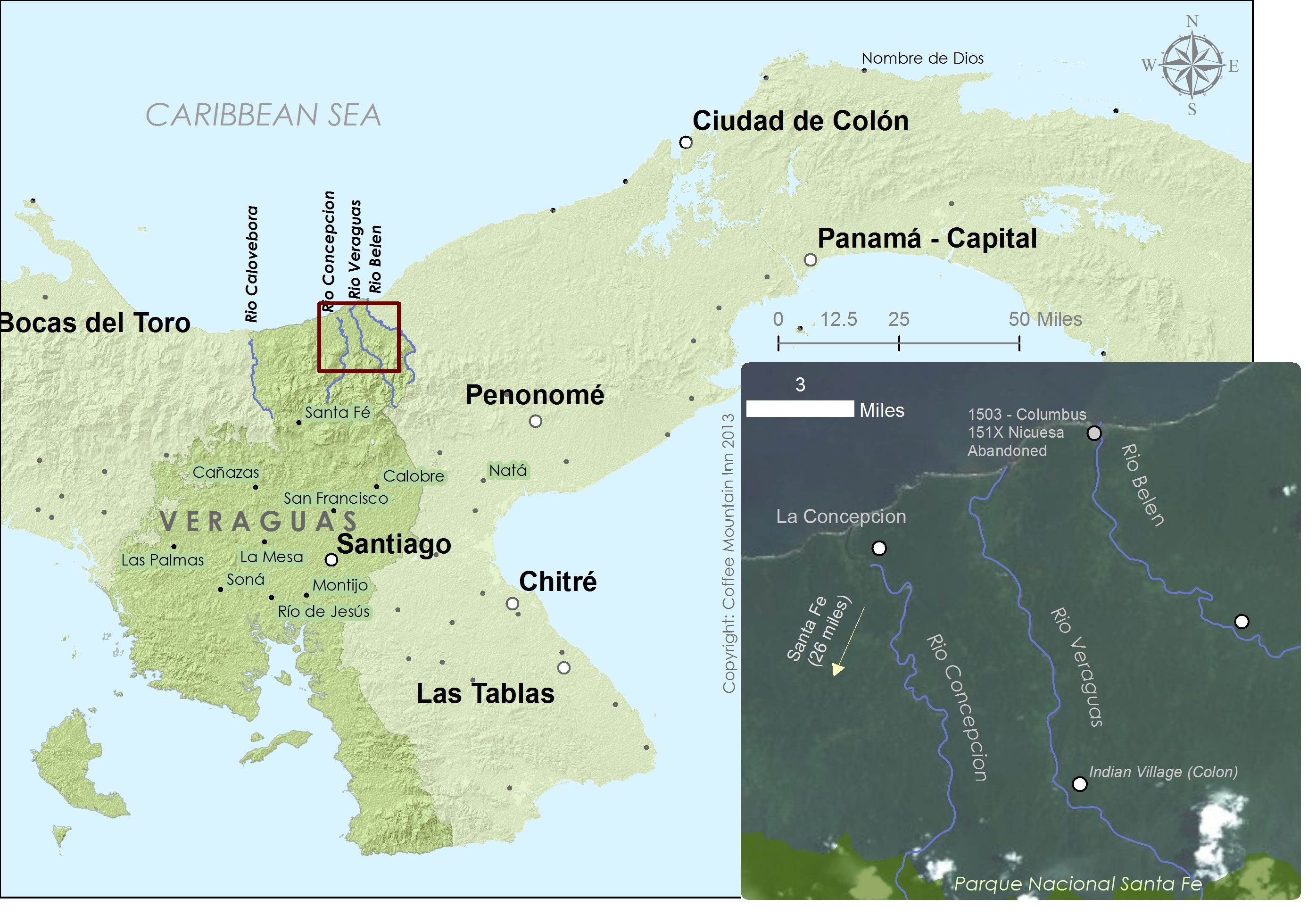
It started when I was looking at Google’s new Google Map Engine and the maps showing the world’s landscape that is not covered by roads.
North Veraguas is such a place, but oddly enough, Rio Belen, Rio Veraguas and Rio Concepcion were home to some of the earliest settlements in the New World (failed settlements, but colonies just the same). I started doing a bit more reading and got hooked.
Christopher Columbus Starts a Settlement in Veraguas
Christopher Colombus (or Colon in Spanish), sailed down with his brothers along the Central American Coast in their fifth voyage from Spain in 1502. They stopped to trade in the indigenous villages along the coast of “Veragua” and were impressed with the apparent wealth of gold that Columbus tried to establish a base at the mouth of Rio Belen, leaving his brother in charge. Their goal- to find and discover gold. Their technique – kidnap the nearest indian chief who lived on Rio Veraguas and say you’ll let him go if he gives you a lot of gold. Do you think this technique helped win friends and influence people? Nope. Turned out that the chief’s supporters didn’t really like this idea, and attacked the barracks that Colon had established. Drove the sailors out.
Please eliminate my competition for me!
A little manipulation goes both ways. A few weeks prior, the indian chief had offered to show the explorers where he got his gold from. Sailors traveled by boat to his town on Rio Veraguas, then by foot for 16 miles through the jungle to come to an area where gold could be gathered with little effort. Great, right. Rumor is that the indian chief showed the sailors -not where he mined for gold – but where a competing cacique’s mined for gold.
It’s mine, mine, all mine…if only I can find it again
After, Colon and his brother left, he remained so strongly convinces of the promise of gold in the area, that he erased Veraguas coast and Belen from his maps, to keep the location a secret.